Rossett is a Village with a Recent History of Flooding
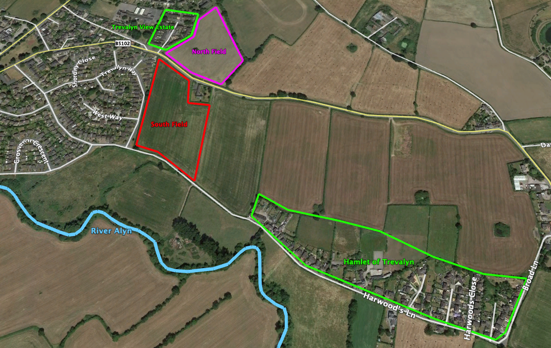
Rossett is a village with a recent history of flooding. A number of planning applications by housing developers have been rejected over the years, some were appealed but still not granted. The latest rejection in 2019 was again challenged but the appeal this time was successful. A London Barrister commenting on the appeal decision stated that on pure planning judgement “the justification is thin”. Let’s look at the known facts, the map below shows locations mentioned it the following text:
1950’s
The northern parcel of land has been the subject of a number of development applications, the first recorded was in the late 1950s when Wrexham Urban District Council started the Trevalyn Hall View Estate. This development was abandoned in 1958 when the row of terraced houses facing the Northern parcel of land had to be evacuated as a result of the spring and aquifer lifting the floors of the dwellings. The Local Authority, after much expense on the repairs and upgrade of the properties decided not to extend the roadway and buildings into the northern parcel. The Committee Reports and other information on this incident will be found in WCBC Archives.
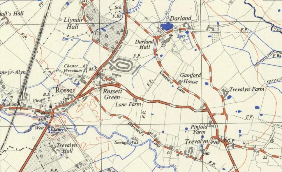
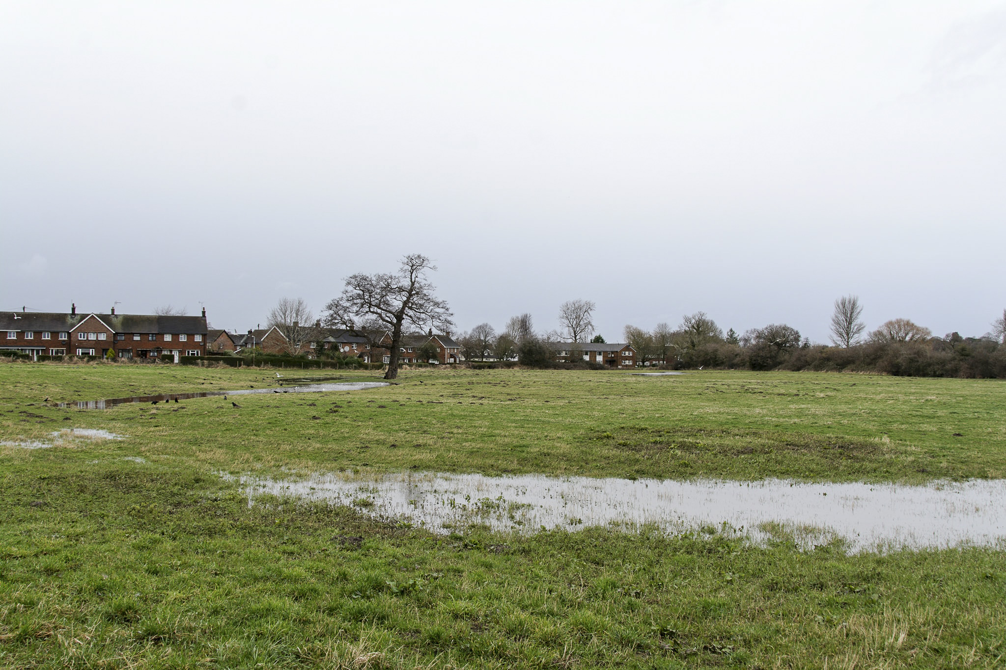
Local residents have continually reported that there is a spring in the field and that the level of the water table is only about 300mm below ground level. This field is continuously waterlogged from September to April every year which is evidenced in a photo log held by local residents. An OS map from c1950 clearly shows the spring rising in the North field (north of Lane Farm) and a stream making its way towards 2 ponds adjacent to Gamford Lane.
1970’s
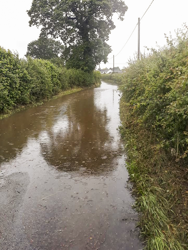
In September 1976 the whole village was flooded from Station Road to Trevalyn and the River Alyn closed Harwoods Lane from the tree at the SW corner of the Southern parcel of land through to the cottages in Trevalyn. This serious flooding took place before the Estates on Harwoods Lane, Alyn Drive and Trevalyn Way were completed so there were no local residents at this time other than those at the Rossett Green end of Harwoods Lane or the hamlet of Trevalyn.
Note – Natural Resources Wales and its predecessor Environmental Agency never attended a flood event in Rossett until after C1 flood plain defences were constructed in Station Road. They have no records of flood levels in Rossett before 2010.
Local flood level records indicate that the highest the river reached was 2.89m above normal as measured in Gun Street Rossett in 1976. Hydraulic modelling has been carried out elsewhere on the River Alyn, this has shown that when the River Dee is in flood and at high tide it results in flooding by the River Alyn. NRW advised hydraulic modelling for this site but as far as Planning Records show this was never carried out in this location.
2000’s
The second most serious flooding incident occurred on the 6th/7th November 2000 when the River Alyn peaked at 2.79m above normal at 23-45 hrs on the 6th November. This river flood level was recorded in Alyn Drive, Rossett. Sandbagging was necessary in Trevalyn Way and the Alyn Drive areas of Rossett. More detail can be found in this article.
This sandbagging fact was denied at the 2003 Unitary Development Plan, Examination in Public Hearing, by the Local Planning Authority. This denial is contrary to the statements made since by the Wrexham County Borough Council Duty Flood Officer who ordered the sandbag protection of the properties then at risk from flooding.
Furthermore, it is known that The LPA used the local YouTube Recording showing the actual flooding in Rossett to support the removal of an unauthorised Gypsy Site in Rossett. See actual recording in Video tab.
In spite of this the LPA continue to refuse to acknowledge the significant ongoing flooding risks as do Natural Resources Wales who do not consider that a site now deemed level with a C2 flood plain present risks of flooding.
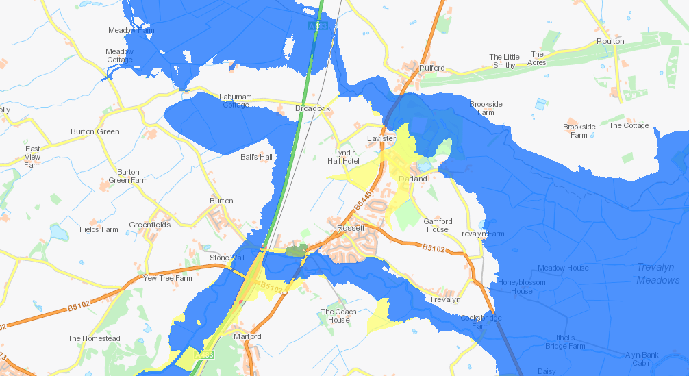
Key:
Green – Zone C1: Served by significant infrastructure, including flood defences
Blue – Zone C2: Without significant flood defence infrastructure
Yellow – Zone B: Areas known to have been flooded in the past
Clear – Zone A: Considered to be at little or no risk of flooding
Local Residents witnessed the height of the River Alyn where it breached Harwoods Lane and entered the Southern parcel of land with major runoff into Trevalyn Way and Moss Green Rossett. The Inspector at the time of the UDP ruled the risk from historic flooding was too great and refused to include the northern parcel of land in the UDP.
Over 50 witness statements and over 100 photographs illustrating the degree of flooding to the area from the 2003 UDP Inquiry were submitted to NRW and they have now amended the boundary of the C2 floodplain abutting the southern parcel of land. NRW accept that the limit of the flooding on Harwoods Lane. starts at the tree on the South Western corner of the southern land parcel datum 51.14 (13.62 AOD) with the majority of the site substantially lower than this arbitrary datum therefore being by inference at risk of flooding and confirming that the run off into Moss Green and Trevalyn Way was in fact Fluvial.
The third major fluvial event on the 13th June 2019 did not create similar run-off but totally waterlogged both parcels of land. On that date the highest recorded River Alyn, Rossett measurement held by NRW is a level of 2.19m. On that occasion the river never breached Harwoods Lane although the road was still totally closed by flooding.
The Rossett Focus Group submitted a 300 page rebuttal to the planning appeal Inspector, 47 pages of which dealt with the flooding and drainage history of the site. This will be a subject for further comment on this website.