
Rossett Doesn’t Need and Doesn’t Want This Development
Welcome – You have arrived on this web page because you have probably seen one of our protest banners or notices that have started appearing around the village. Flooding is not the only issue in Rossett as we will discuss later, however it should be a major concern to anyone considering property purchases in certain Rossett postcodes.

Summary
To summarise – if this development goes ahead we can only warn about the situations that will exist in choosing to purchase a property on the development North & South of Rossett Road.
-
- Class action will be taken for the damage caused if any existing local property is flooded due to run-off from the development (see sect.1 and specifically para. 1.10)
- Access to school places (primary and secondary) cannot be guaranteed (see sect. 3)
- Access to primary health care services (GP Surgeries) cannot be guaranteed (see sect. 2).
- Road safety for school children, disabled persons, cyclists and children in push-chairs is clearly being ignored (see sect. 4).
The following details expand on the issues raised above.
Flooding History
The Village of Rossett has been subject to a number of planning applications over the years and these have always been opposed by Members of the Wrexham Council. The New Development North & South of Rossett Road was refused by Councillors but it was appealed and granted by the Welsh Minster on the advice of a Planning Inspector. The site was only approved because Wrexham needed houses somewhere in the Borough. The Planning Inspector actually endorsed the grounds the Council refused the application but the appeal was granted ignoring the following facts: –
1. Flooding and Insurance Risk
- The site abuts the River Alyn flood plain and the River has burst its banks many times in the last 50 years with drastic flooding to the village in 1976 and 2000.
- Residents living near this site have been refused flood insurance and mortgages for a number of years as the development site boundary along Harwoods Lane has been adjudged only recently by Natural Resources Wales (NRW) as level with the River Alyn flood plain.
-
- The photographs that you see displayed on Banners around the Village are records of the surface water flooding that occurred in June 2019 and February 2020. The River Alyn did burst its banks but did not reach the development site on that occasion.
- NRW categorically state that the sites are not at high risk of flooding but do not factor into their advice climate change which is a very real risk on land level with a flood plain, especially as both parcels of land are inherently waterlogged most winter months from October to March.
- The photographs that you see displayed on Banners around the Village are records of the surface water flooding that occurred in June 2019 and February 2020. The River Alyn did burst its banks but did not reach the development site on that occasion.
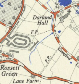
- The northern parcel of land was included for development in the 1950s and was abandoned by the Council in 1958 when the houses facing the site in Trevalyn Hall View were evacuated due to the spring and aquifer under the land lifting the floor slabs warranting massive repairs before they could be re-occupied.
Old OS map Pre 1950s development showing aquifer and stream in North field. The large Alder tree growing in the field is at the point where the aquifer rises.
In 2003 a Planning Inspector refused planning consent on the Northern Field due to historic flooding and advised a precautionary approach due to the flood risk.
-
- In 2000 the November Flooding incident was so intense that the houses and bungalows in Trevalyn Way were sandbagged by the Council to overcome the massive run-off from the Southern Field into Trevalyn Way.
- In September 1976 the flooding in the Village was even greater than 2000 and the high-water marks in Harwoods Lane and Gun Street were recorded by the Residents. Harwoods Lane in those days was just a country lane and the flood line was bounded by the large tree on the corner of Trevalyn Way and Harwoods Lane. Harwoods Lane was closed for a week cutting off the road to Trevalyn. The River Alyn reached a height of 2.89m above normal.
- In 2000 the flood lines were almost as high, 2.79m above normal and the Wrexham Council Duty Flood Officer confirms the flooding extent to the village and that Harwoods Lane was breached by flood water almost to Trevalyn Hamlet which required sandbagging to prevent damage to the cottages on Harwoods Lane. We have in addition to that testimony of the Duty Flood Officer, statements from local residents confirming the height of flood waters on that occasion.
- The speculators Flood Consequences Assessment (FCA) Report has plans for the gardens of the new properties to be flooded in the event of the drainage capacity (SUDs) being exceeded. This policy of garden flooding is deprecated by the latest draft TAN 15 that gives guidance to flooding matters in Wales. No apparent consideration has been given in the FCA to flood water run on or run off from the site.
- For information, the Records held by NRW on flood levels in Rossett only commenced in 2010 when the defences along Station Road were strengthened and these indicate only a maximum River Alyn height of 2.19m above normal in June 2019.
NRW have never attended a flood incident in Rossett, they always relied upon WCBC to respond and they have no record of the 1976 event and their records for 2000 are derived from a Police Helicopter Flyby. Unless the Flyby took place, in full darkness at midnight on the 6th November 2000, then the height of flood lines established by local residents and the Council Duty Flood Officer cannot be disputed.
- In 2000 the November Flooding incident was so intense that the houses and bungalows in Trevalyn Way were sandbagged by the Council to overcome the massive run-off from the Southern Field into Trevalyn Way.
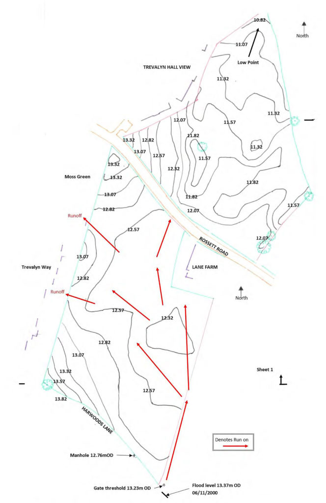
Topograpy of North & South Fields
The 2000 flooding is known to have peaked at a height of 15.79m Above Ordnance Datum (AOD) at 11:45pm on 6th Nov 2000.
Note that the maximum elevation of these 2 fields is 13.82m. Also that no flood defences exist in this area of the River Alyn. (The only flood defence in Rossett is in Station Road)
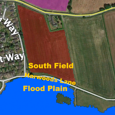
Flooding run-off is illustrated by the topographical map derived from the speculators data. The South field was subjected to River Alyn flood water with knock on flooding into Trevalyn Way and Moss Green with water subsequently crossing Rossett Road into the North Field and Trevalyn Hall View.
2. Primary Health Care
-
- We would draw attention to the parlous state of primary health in this and the surrounding area covered by Alyn Family Doctors (AFD).
- Prior to the Covid-19 pandemic the local doctor’s practice was unable to cope with the high numbers of patients coming on to its register.
- The AFD practice already covers Gresford, Llay, Marford, Rossett and some extra 1000 patients over the border in Cheshire.
- With nearly 500 properties already under construction in the area, all of which are hoping to register with the practice for their health care, it is uncertain whether any of those or any new patients in Rossett can/will be added to the patient register.
- We would draw attention to the parlous state of primary health in this and the surrounding area covered by Alyn Family Doctors (AFD).
- In 2018 AFD announced that they were consulting on moving their Gresford Surgery/Health Centre services to Llay and Rossett due to safety concerns. If this transpires then it will place further pressure on the Rossett Surgery which is based in a small terraced house.
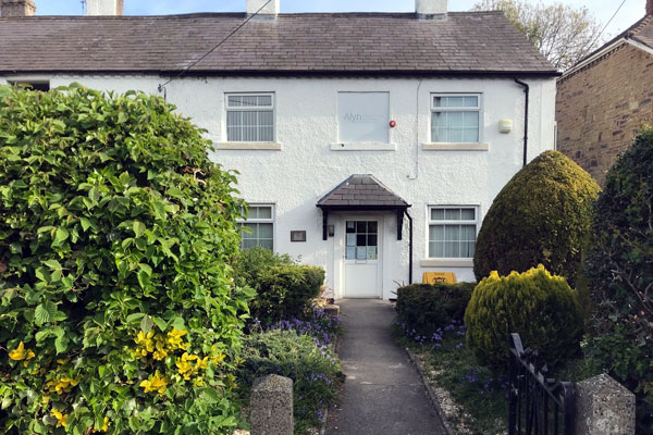
Alyn Family Doctors Surgery
Station Road, Rossett
3. Education
-
- The 70-year old local primary school is judged to be at capacity and that new residents’ children will probably be sent to the Rofft School at the top of Marford Hill.
- Regarding secondary education Darland High School is almost at capacity and will be under pressure to take further admissions when the 500 houses mentioned above are finished and occupied, let alone the 132 houses in prospect in Rossett.
- The 70-year old local primary school is judged to be at capacity and that new residents’ children will probably be sent to the Rofft School at the top of Marford Hill.
4. Highway Safety
-
- The new development will not be served by roadways with adequate footways. The Rossett Road improvements suggested by the speculator do not meet the safety standards required by the Manual for Streets, Welsh Government TAN18 or WCBC Local Planning Policy.
- Chapel Lane has in large part no footways, but the Welsh Minister finds that these inadequacies of the development site do not impair the grant of Planning Consent.
- The new development will not be served by roadways with adequate footways. The Rossett Road improvements suggested by the speculator do not meet the safety standards required by the Manual for Streets, Welsh Government TAN18 or WCBC Local Planning Policy.
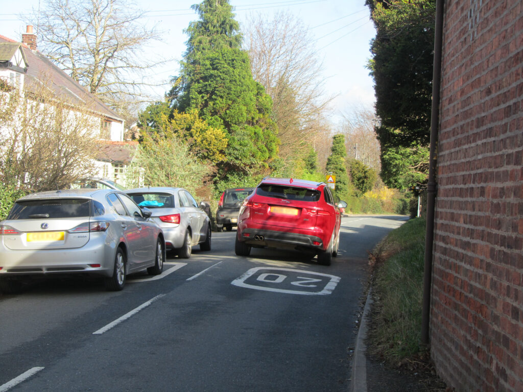
Holt Road, the only access leading from the village centre to the proposed development site.
All the routes from the other direction have load restrictions. Note that the left has no pathway between the houses and road.
The pedestrian access here would be shared by construction traffic, school children, push-chairs, cyclists and agricultural traffic.
5. Links to More Detail
Flooding on 6th November 2000 -The flooding is known to have peaked at a height of 15.79m Above Ordnance Datum (AOD) at 11:45pm on 6th Nov 2000.
A 19 Minute Video of the above flood.
History of Previous Flooding – 1950 to 2020 – Rossett is a village with a recent history of flooding. A number of planning applications by housing developers have been rejected over the years, some were appealed but still not granted.
Gallery of Flooding Photographs – Images of the floods from 1976 to the current day.
Flood Risk and Household Insurance – Five insurers on the Flood Re list have already declined insurance cover locally on houses built before 2009. If you are not insured with them already they are not obliged to quote.