Rossett Says NO to Development on Bellis Fields
NOT WANTED and NOT NEEDED
Development in the north field was abandoned in 1958 when the houses facing in Trevalyn Hall View were evacuated due to the spring and aquifer under the land lifting the floor slabs warranting massive repairs before they could be re-occupied.
The records held by Natural Resources Wales on flood levels in Rossett only commenced in 2010 when the defences along Station Road were strengthened and these indicate only a maximum River Alyn height of 2.19m above normal in June 2019.
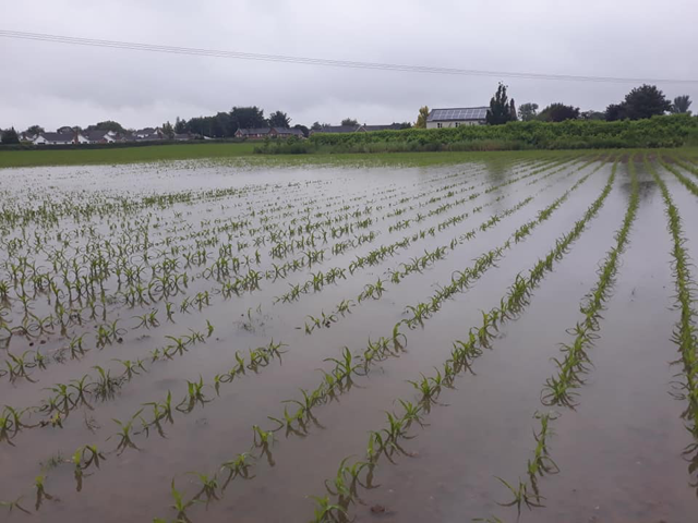
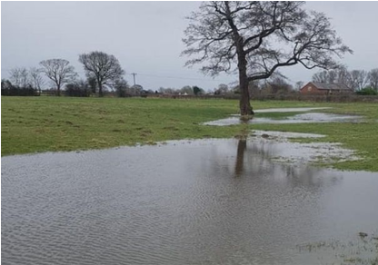
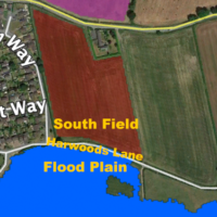
In 2000 the south field was subjected to River Alyn flood water with knock on flooding into Trevalyn Way and Moss Green with water subsequently crossing Rossett Road into the North Field and Trevalyn Hall View.
The development area has issues with flooding, insurance risk, health care, education and highway safety that are not going to be resolved by building more unwanted and unneeded housing. To find out more click the read more… button.